This week Jews around the world celebrate the festival of Hanukkah. In Hebrew the word חנוכה (hanukkah) means “inauguration” or “consecration” and refers to the Maccabean capture of Jerusalem and the purification of the Temple on the 25th day of the month of Kislev in 164 BCE. Most people are familiar with this triumphant end to the Hanukkah story, but fewer people know about the dramatic events leading up to this victory. Over a two-year period the Maccabees carried out a series of audacious guerilla attacks on the mighty Seleucid army. The most famous battles took place at three locations described in the the opening chapters of the First Book of Maccabees: Beth-horon, Emmaus and Beth-zur. Why were these critical battles fought in these particular places?
The answer is quite simple: these were all important Seleucid strongholds, each one strategically located along one of the three main roads leading from the Mediterranean coast to the Jerusalem hills.
But to understand this, we need to back up for a moment and provide a bit of historical and geographical background. Following the death of Alexander the Great in 323 BCE, the newly Hellenized land of Israel became the battleground between his successors: the Ptolemies of Egypt and the Seleucids of Syria. In the 2nd century, tensions came to a head as the Seleucid king Antioches IV Epiphanes instituted an unprecedented series of religious decrees designed to eliminate the particularism of the Jews. His goal was to strengthen his hold over his empire by imposing Hellenism to eliminate sectarianism. This is what gave rise to the Maccabean Revolt. Now, a few words about the basic topographical profile of the land. The land is composed of five longitudinal bands, each having its own particular geological qualities. From west to east these zones are as follows: (1) the sandy coastal plain, (2) the chalky Shephelah lowland, (3) the hard limestone central hill country, (4) the soft limestone Judean desert, and (5) the alluvial Jordan Rift Valley. Like many of the most important biblical cities, Jerusalem is located on the watershed in the central hill country. Notice the the north-south bands in these two topographical maps.
At 750 meters (2450 feet) above sea level, Jerusalem is not a particularly elevated city. But the ascent to Jerusalem from the coast can be treacherous. The 55 km journey from the port of Jaffa to Jerusalem is characterized by steep climbs and descents which repeat over and over. As a result, since antiquity travelers have been limited to three main routes which provide the most logical access to the capital. The three cities mentioned above are situated in places that control these three topographically convenient routes, thus avoiding the needless up and down. Let’s take a closer look at each of them.
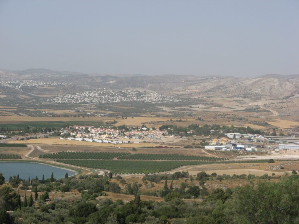
Beth-horon is located about 15 miles northwest of Jerusalem. The name means the “house of Horon”, referring to the ancient Canaanite god of shepherds. It was apparently a holy city in the pre-Israelite era. But the real importance of Beth-horon is its strategic location. It dominates one of the most important east-west ridges that gently leads up to to the hills of Jerusalem: the Way of the Ascent of Beth-horon. Today a modern road called Highway 443 runs on the same ridge. Because this is such a crucial route connecting the coastal plain to the central hill country, it was often the site of battles in the Bible. It features famously following Joshua’s battle at Gibeon against the five Amorite kings:
So Joshua came upon them suddenly, having marched up all night from Gilgal. And the Lord threw them into a panic before Israel, who inflicted a great slaughter on them at Gibeon, chased them by the way of the ascent of Beth-horon, and struck them down as far as Azekah and Makkedah. As they fled before Israel, while they were going down the slope of Beth-horon, the Lord threw down huge stones from heaven on them as far as Azekah, and they died; there were more who died because of the hailstones than the Israelites killed with the sword. (Joshua 10:9-11)
Although not mentioned explicitly, the Way of the Ascent of Beth-Horon is also certainly the route used by Saul to push the Philistines west out of the hill-country: “from Michmash to Ayalon” (1 Samuel 14:31).
Our second site, Emmaus is located 8 miles west of Beth-horon along the same ancient route just described. But unlike Beth-horon, Emmaus is not situated in the hill country on a ridge. Instead it is located in the Shephelah, the lowland that forms a buffer between the coastal plain and the hill country. This chalky region is crisscrossed by a series of east-west valleys (or wadis, dry streambeds) which were crucial travel routes in antiquity. The importance of Emmaus is that it dominates one of these valleys: the Ayalon Valley. The road to Emmaus features famously as the site of one of Jesus’ appearances to his disciples following the resurrection (Luke 24:13). However, many scholars believe this is a reference to a different site by the same name. During the Roman period, it was renamed Nicopolis.
The third site, Beth-zur is located about 20 miles southwest of Jerusalem in the vicinity of Hebron. Its name means, the “house of the rock”, a reference to one of God’s epithets. So, like Beth-horon, it was likely a holy city. But like Beth-horon, its major importance derives from its strategic location. It is situated in the central hill country at a high point that dominates the ridge that formed the main road linking the Patriarchs’ cities: Beer Sheba, Hebron, Jerusalem, Bethel and Shechem. Beth-zur is right on this watershed road, just north of Hebron, a crucial city guarding the southern approach to Jerusalem.
We have seen that Beth-horon, Emmaus and Beth-zur are all located at tactical locations, alongside the three main access routes to Jerusalem from the northwest and southwest. The major goal of the Maccabees was to reconquer Jerusalem and reinstate the sacrifices in the Temple, which had been defiled and turned into a pagan sanctuary by Antioches IV three years earlier. Their main obstacle was the Seleucid garrison stationed in Jerusalem’s citadel. Rather than attack this mighty fortress head-on (which would certainly have failed), the Maccabees opted for an alternative technique: cut off their supplies coming from the west along these three roads. The Maccabees originally hailed from the village of Modi’in. They were therefore intimately familiar with the landscape of the Shephelah and the routes leading up to Jerusalem from the west. They used guerilla tactics to defeat the standing armies of the Seleucids at these three sites. By controlling these three cities and their respective roads, the Maccabees ensured that the Seleucids were neutralized down in the coastal plain. Having done so, they could securely proceed up to Jerusalem to liberate the city and cleanse the Temple, celebrating the Festival of Hanukkah “with joy and gladness for eight days” (1 Macc. 4:59). Why eight days? I will answer that question in the next post.
Happy Hanukkah!




Join the conversation (No comments yet)