
Many people know that the ancient city of Rome was built on seven hills, the outlines of which are still visible today. Fewer people know that the ancient city of Jerusalem was built on two hills. These hills are known simply as the “eastern hill” (the Upper City) and the “western hill” (the City of David and Temple Mount). To find out more about how understanding the topography of Jerusalem will make you a better reader of the Bible, keep reading.
Imagine two loaves of bread lying side by side. These are Jerusalem’s two elongated hills. They are not particularly high in elevation, both being less than 800 meters above sea level. But they are well defended due to the deep ravines that surround them. Three dramatic longitudinal (north-south) valleys form the outlines these two hills: the Ben-Hinnom Valley on the western flank, the Kidron Valley on the eastern flank, and the Tyropoeon Valley right down the middle. All three valleys are actually wadis: dry riverbeds that serve as drainage channels evacuating rainwater during the wet season. The three wadis merge into one just south of the City of David and take Jerusalem’s rainwater eastwards down to the Dead Sea drainage basin.
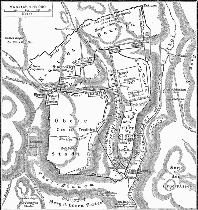
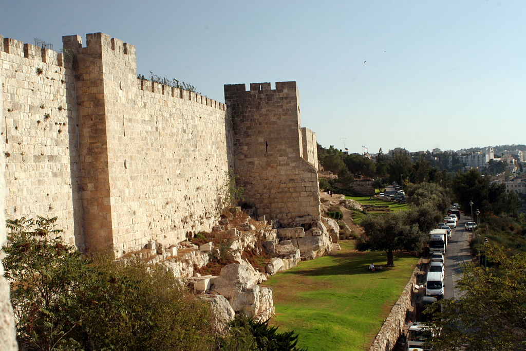
These three valleys – forming the Hebrew letter shin (ש) – have played a very significant role in the urban development of Jerusalem. Over the last four thousand years, Jerusalem has changed hands dozens of times. But throughout the centuries, the city’s various rulers have all consistently built the city’s walls on the ridges which overlook these valleys. The strategic advantage is clear: a conquering army must climb out of the valley, clambering up the steep slope and only then encounter the city’s fortifications. This means that for millennia Jerusalem’s eastern and western walls have followed the natural topographical contours dictated by these longitudinal valleys. This also means that Jerusalem’s expansion was limited to the finite space upon these two hills. Evidence of layer upon layer of ramparts built along the same ridge can be seen today outside the Armenian Quarter in the vicinity of the HaBonim Garden.
The Ben-Hinnom and Kidron Valleys are mentioned numerous times in the Bible and are well-known to anyone who has visited Jerusalem. Much less discussed by historians is another valley that has played a crucial role in Jerusalem’s development: the Transversal Valley. Contrary to the well-known longitudinal (north-south) valleys discussed above, the Transversal is a rare example of a latitudinal (west-east) valley.
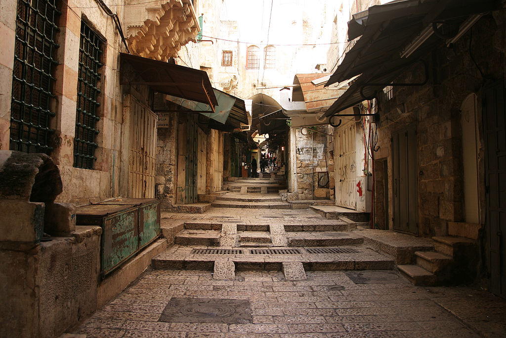
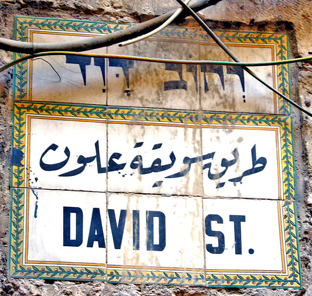
Today the contours of this valley can be seen beneath the busy market street (Suq al-Bazaar) that begins at the Jaffa Gate and proceeds eastwards downhill towards the Muslim Quarter where it merges with the Tyropoeon Valley. Since the Crusader Period this street has been known as David Street. After intersecting the old Roman Cardo Maximus (Khan el-Zeit), this street enters the Muslim Quarter and changes its name to Bab al-Silsila (“Gate of the Chain”) Street.

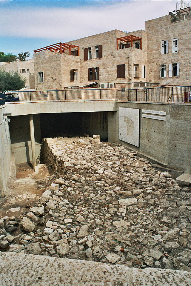
Although the Transversal Valley is smack in the center of today’s Old City, this has not always been the case. Throughout the First Temple Period and much of the Second Temple Period, this valley formed the northern boundary of the city. Fortifications were built on the ridge just south of this valley to increase its strategic value. One example of this is the Broad Wall which can be seen exposed in the Jewish Quarter. This is a remnant of the massive northern ramparts built by King Hezekiah to withstand the Assyrian invasion of 701 BCE.
One reason why it is important to understand the trajectory of the Transversal Valley is because of what lies to its north: the Christian Quarter. What is the reason the Christian Quarter is where it is? Because over the centuries Jerusalem’s Christians have sought to live as close as possible to the city’s most venerated church: the Church of the Holy Sepulchre, located at the epicenter of the quarter. What is the reason the Church of the Holy Sepulchre is where it is? Because it is built upon the sites of the crucifixion and burial of Jesus, which were both located outside the city walls in the first century CE. What is the reason these sites were outside the city walls at this time? Because in the late first century BCE, King Herod wished to take advantage of Jerusalem’s natural topography and reinforced the northern wall (which Josephus calls the First Wall) along the ridge overlooking the Transversal Valley.

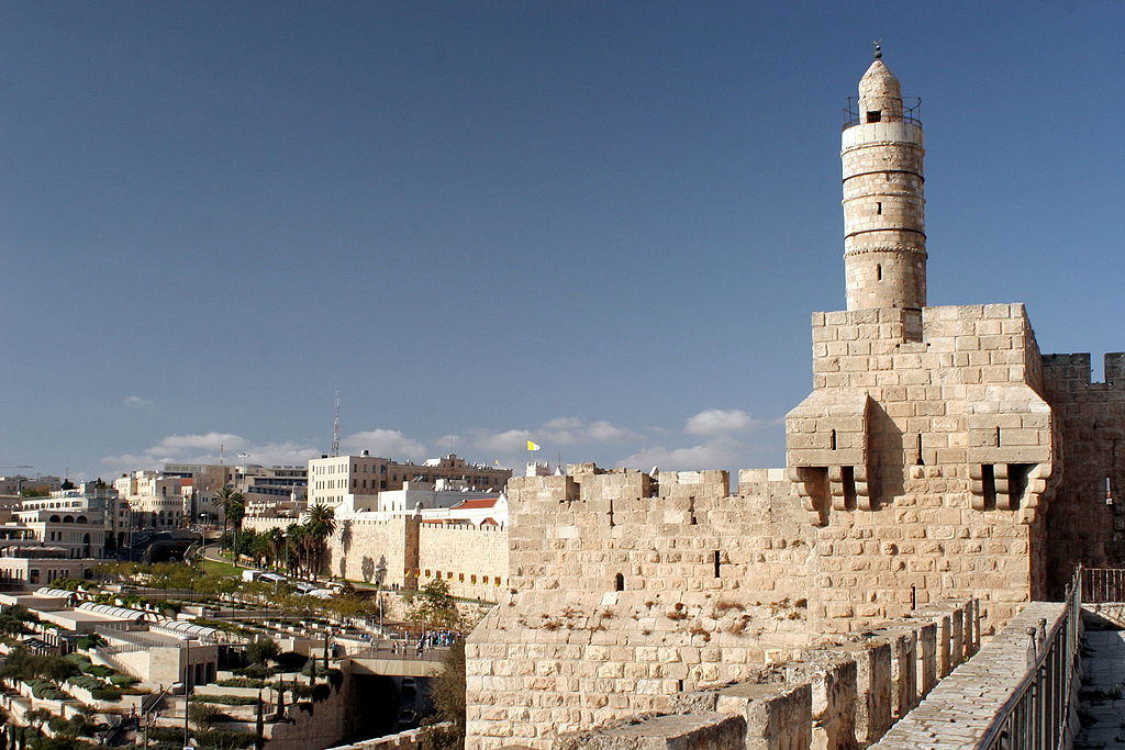
Herod also built a massive fortress, the Citadel, at the point where the Transversal Valley leaves the watershed and begins its eastward drop. The Herodian citadel contained three towers: Mariamne, Hippicus and Phasael. This is the basis for the iconic Tower of David complex which overlooks the Jaffa Gate today.
 It was imperative to fortify this location because to its north there is no naturally deep valley protecting the city. Instead, at this point the western hill simply levels off into a rather flat plain. All of Jerusalem’s rulers understood that the city’s weak point was its northwestern corner. The prophet Jeremiah makes this geographical point clearly when he declares:
Then the Lord said to me: Out of the north disaster shall break out on all the inhabitants of the land. For now I am calling all the tribes of the kingdoms of the north, says the Lord; and they shall come and all of them shall set their thrones at the entrance of the gates of Jerusalem, against all its surrounding walls and against all the cities of Judah. (Jeremiah 1:14-15)
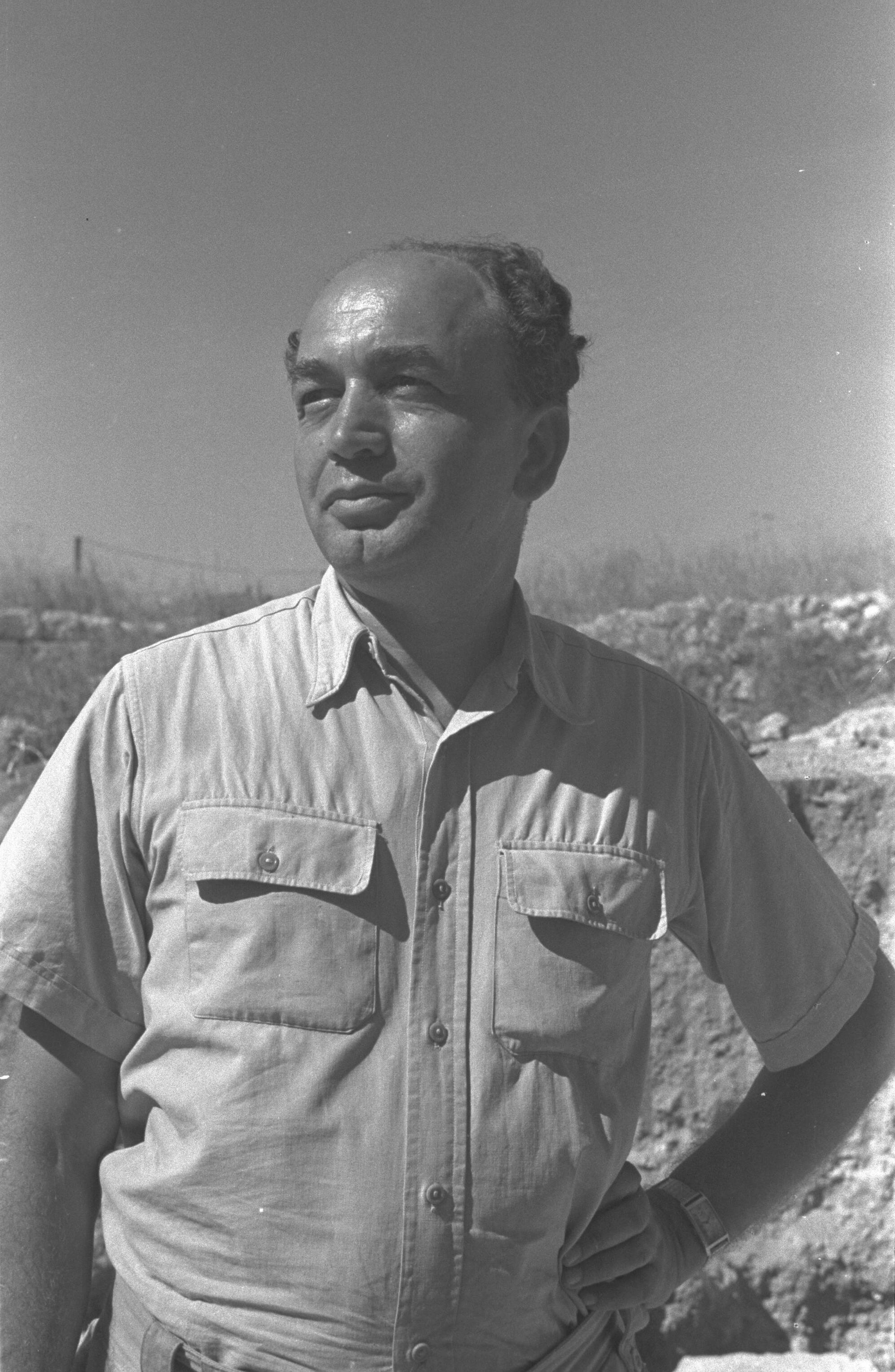
To conclude, I will note an interesting feature of this valley relates to its Hebrew name: Nahal Tzolev (נחל צולב). This name is not ancient and was only coined in the 1960s by the Israeli archaeologist Nahman Avigad who excavated much of the Jewish Quarter following the Six Day War.
Literally this name means the “Crossing Valley” which is synonymous with the English name Transversal Valley. But the Hebrew word “crossing” (tzolev) is built on the same root as the verb which means “to crucify”. How fitting that this dry riverbed which has played such an important role in the events which became the bedrock of the Christian faith should bear such a Christian-sounding name.

[…] because this site located upon the summit of Jerusalem’s western hill (known as the “Upper City“), this is the most elevated part of the Old City. The topography perhaps explains the real […]